I always loved maps. On the other side I have no
plans to invest any money into a car navigation system and also do
not use
any PDAs that could host maps.
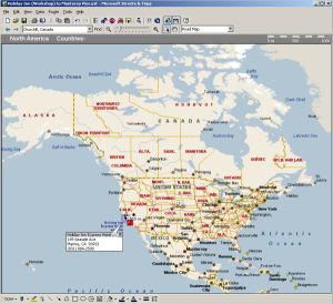
Microsoft Streets & Maps 
But recently I bought a version of Microsoft Streets and Trips to
have some fun. Honestly my expectations were not that high as I did
not even read any reviews before.
Note: This software is only really useful if you look for streets
and places in the US and Canada. Why would you buy a
mapping software for your PC if you have permanently access to Mapquest
or Yahoo maps? Did you ever try to navigate the maps? Yes, you will
experience the full "World Wide Wait".
Basic Navigation The navigation with Streets & Trips is all fun. there are two main
ways to find a place of interest:
- Search for point of interest, city or house in street
- Select an area and zoom in
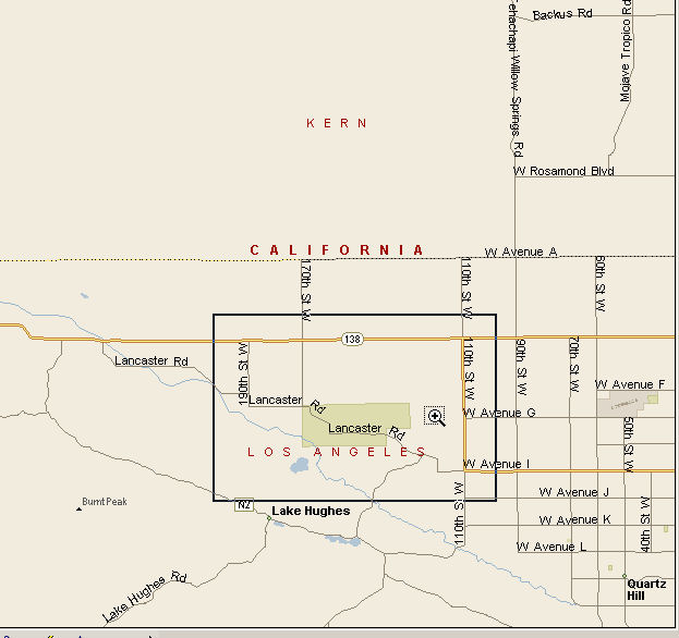
Select Antelope Valley
Above map shows the area near Antelope Valley. You select a rectangle
and click inside.
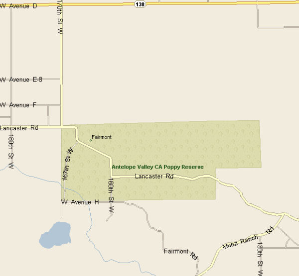
Zoomed in
At that point you can zoom in some more, navigate in the area (keeping
the same magnification) or zoom out. The application also remembers
your history and you can go back where you have been before.
Measure a route 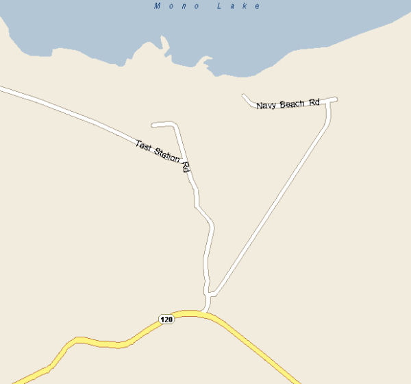
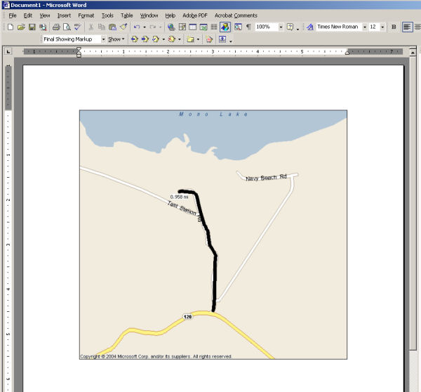
Location of Mono Lake "South Tufa" and "Navy Beach"
If you have been there you know these
roads. You would like to know that these are gravel roads and also
would nice to know that the one spot is "South Tufa" (even requesting
a fee).
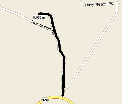
Measuring
You can measure the length of a path
by just drawing a line.
Finding nearby hotels and restaurants
and pushpins
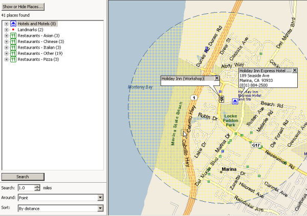
Finding Hotels and Restaurants
The above map show us the location
of our "Shoot,
Process & Print" workshops and the hotel where
we will meet. You can add a pushpin and name it. Later you can find
this pushpin again at "My Pushpins" or using the find dialog.
Then you can select a radius where
to search for hotels and restaurants. You get also some useful phone
numbers for these businesses. Routes
You can also let Streets & Trips calculate
a route between multiple points.
Two samples:
1. Marina hotel to Point Lobos (16.7
miles and 18 minutes). Because we know the area very well this sounds
very realistic to use 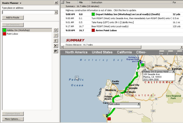
Marina to Point Lobos State Park
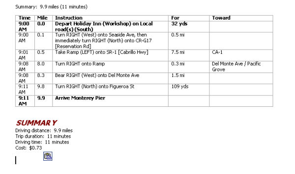
2. Marina to Monterey Pier (9.9 miles
and about 11 minutes)
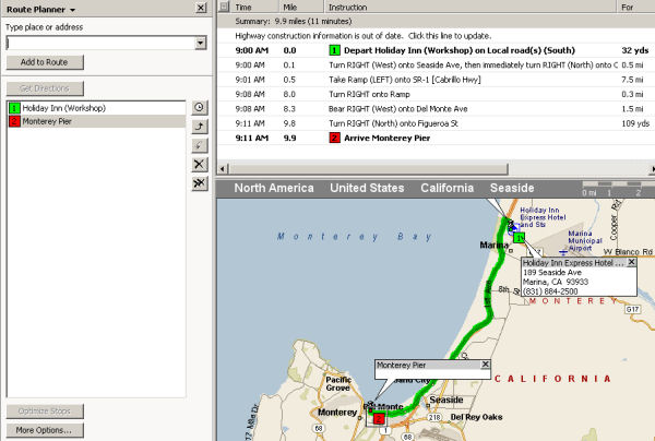
Route from Hotel to Monterey Pier
Printing Maps
You can print the framed map that
is currently displayed on your screen any time.
Copy Data
We also find the copy data function
very useful.
a) Copy maps
Copy Map to Word
This is feature that helps to give
other people driving directions.
b) Copy Routes
Copy Routes to Word
GPS Tracking device
Actually we bought Streets & Trips
for the cool GPS tracking device. Can be very useful with your notebook
outdoors. We hardly use it as Street & Maps is for us a main planning
trip planning application (also installed on our road notebook).
Summary
There is probably even more to explore
but already what we showed here is worth the application for us.
I use hardly anymore Mapquest or Yahoo Maps (except if I foget that
I have Streets & Maps on my machine :-) ). Exploring maps is great fun!
|