8/11/2007 Note of caution: Possible Side Effects of GeoTagging
Note: The tool we used GPSPhotoLinker actually can destroy some of the Maker Data in the RAW file. These data include the lens information (needed for lens distortion corrections). We don't actually think GPSPhotoLinker is the culprit as it seems to use other more common software to perform the task. Best you test it with one file and check that all other EXIF and Maker Data are still fine.
We wait now to see tools that perform the GeoTagging by creating or changing XMP side car files.
7/3/2007
We are not that much drawn to use too many gadgets. We still have no GPS in our car (we have to rethink this). Recently we heard about the DeLorme Earthmate GPS PN-20. Because we like the DeLorme Topo USA maps and the Earthmate includes a full version of these maps we wanted to check it out.

Important is that the device is small and light. Here is how we carry it on our trips:
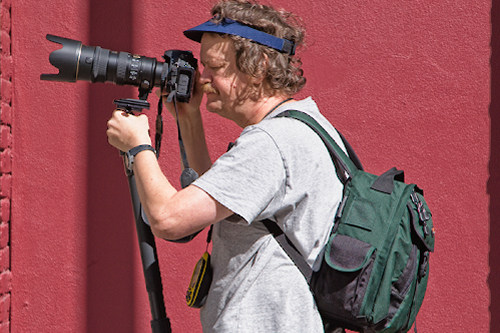
Earthmate hanging around our neck
We tested it the first time during a walk through San Francisco. This is of course a challenge for every GPS because of high buildings and other shady locations.
All we did was turn the device on, created a new Route in the device and left it on. We plan to talk more about the Earthmate device in future postings. Our walk was about 3 hours long and after that we saved the Route in the Earthmate.
At home we transferred the Route data from the Earthmate to our Mac. How that, if the Topo USA software only works on Windows? Actually we run Topo USA using Parallels 3.0 on our Intel Macs. Inside Topo USA we export the Route to a so called GPX file.
Tagging you images with GPS data
With the help of GPSPhotoLinker (Mac only, but there other Windows tools too) we can tag all our Canon CR2 RAW files in Batch mode.
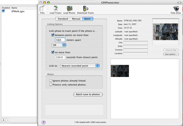
GPSPhotoLinker
Here are the main simple steps
- Load the GPX file
- Load the CR2 RAW files (that takes a while though)
- Save the GPS data in batch to all your RAW files (you can control this process via some options)
Using GPS metadata in Lightroom
Best you perform this operation before you import your RAW files into Lightroom. Once these RAW files are imported into Lightroom you can view and use these data directly from Lightroom. Here is a sample use session.
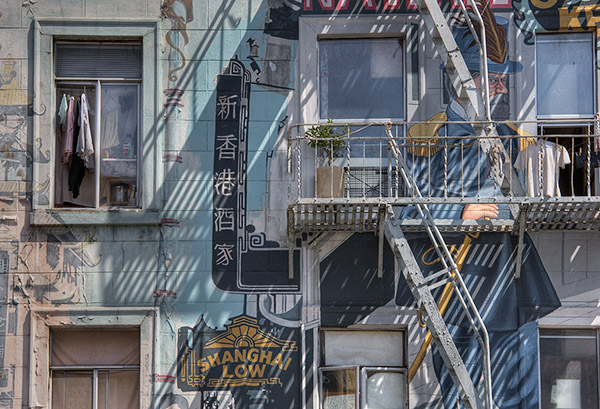
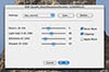
China Town Mural
Lightroom shows the GPS location data:
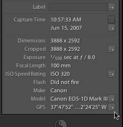
GPS Metadata
If you click on the little arrow on the right of the GPS metadata Lightroom launches Google Maps in your browser:
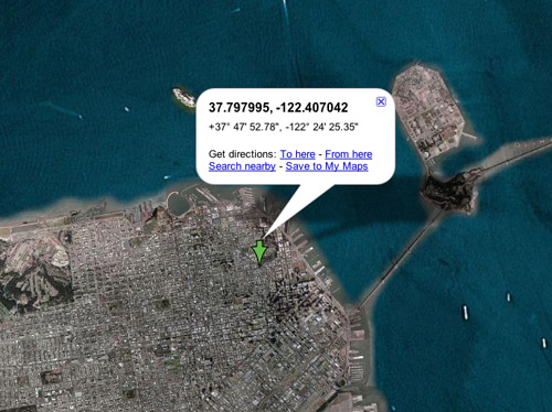
Google Maps
Inside Google Maps you can then zoom in to higher magnification level. In our case we even could use the new Google Maps feature "Street View" and see part of this building:
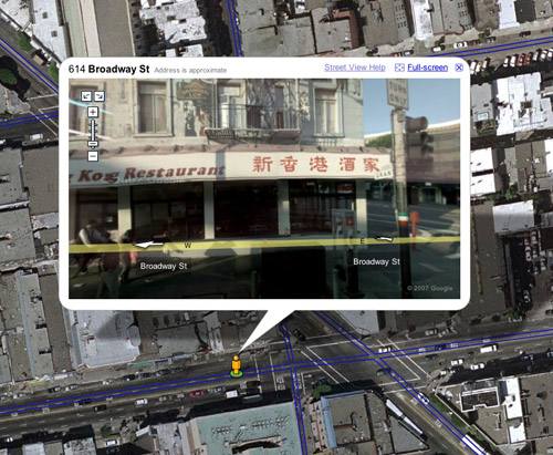
Google Maps Street View
This way you can actually (re-)visit the place using Google Maps "Street View". Not sure how many streets are already covered. The center of San Francisco is covered well (no real surprise though).
Finally you can copy the coordinates to Google Earth and explore even more.
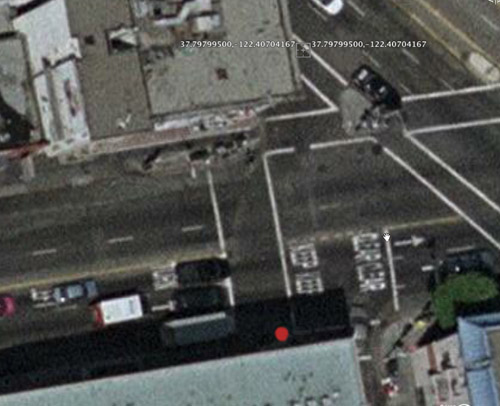
Google Earth view
The automatically tagged location shows the coordinates and the red dot is our real position while taking the photo. For our purposes this is really close enough.
What if your RAW file format is not supported?
Unfortunately the Fuji S5 RAF RAW format is not supported by GPSPhotoLinker and we could not find other tools on Mac. We did a trick and converted all RAW files in Lightroom to tiny small JPEGs (40x40 pixels) and tagged them. This was even a faster process.
We then used in Lightroom the "Auto Stack" feature and stacked these files with the original RAW files. Finally we renamed the GPS-JPEGs like ".z_gpsjpg_"<original filename>. This has two purposes:
- To show via the name that it is now a real image (useful for any nice output)
- The dot makes these files hidden on the Mac and other application won't look for them. You have to perform the renaming after you import the files into Lightroom. You cannot use Lightroom for the renaming process itself (they don't want to help to make images "hidden" as it can cause too many confusions).
This method can also be used if you do not want to disclose the location with your images and don't want to worry about forgetting to strip off all metadata.
This is a bit more work but still worth it.
As you can imagine we got hooked and will carry the Earthmate also on future trips.
|